2.2 KiB
Libre Gps Parser
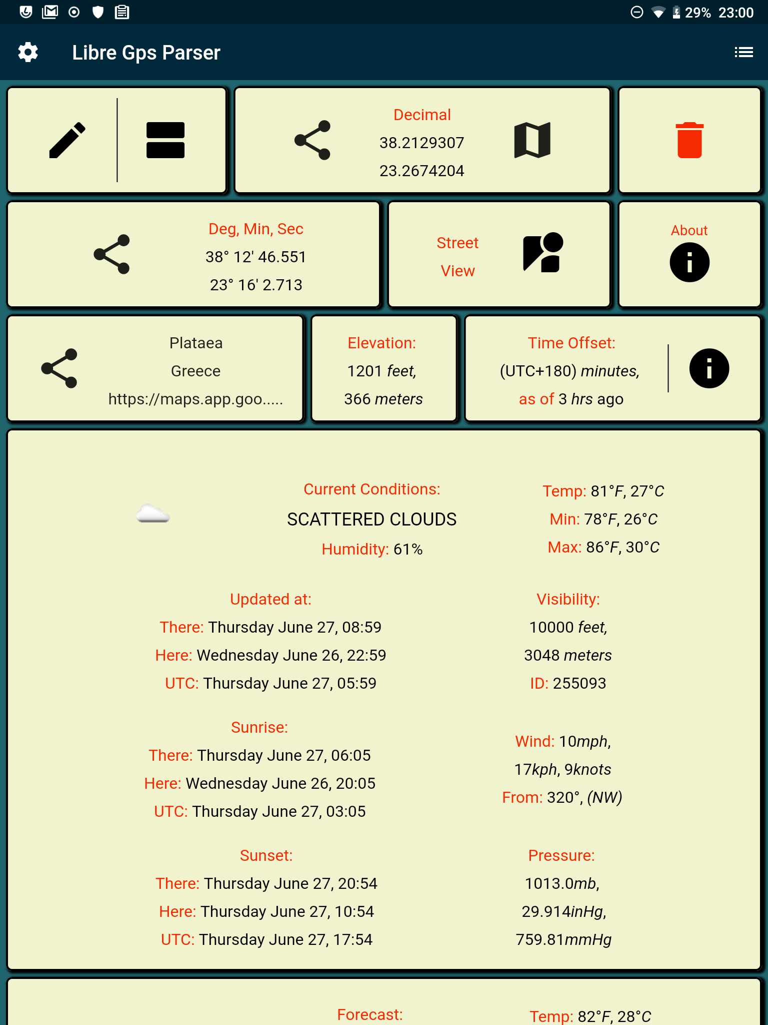
The essence of Libre Gps Parser is parsing gps coordinates from a map location that you share from a map application. The location is requested using the dart http package, and then the raw text result is filtered with regex to pick out the gps coordinates.
You can take a look at the request and regex in
global_helper_functions.dart
parseMapUrl function.
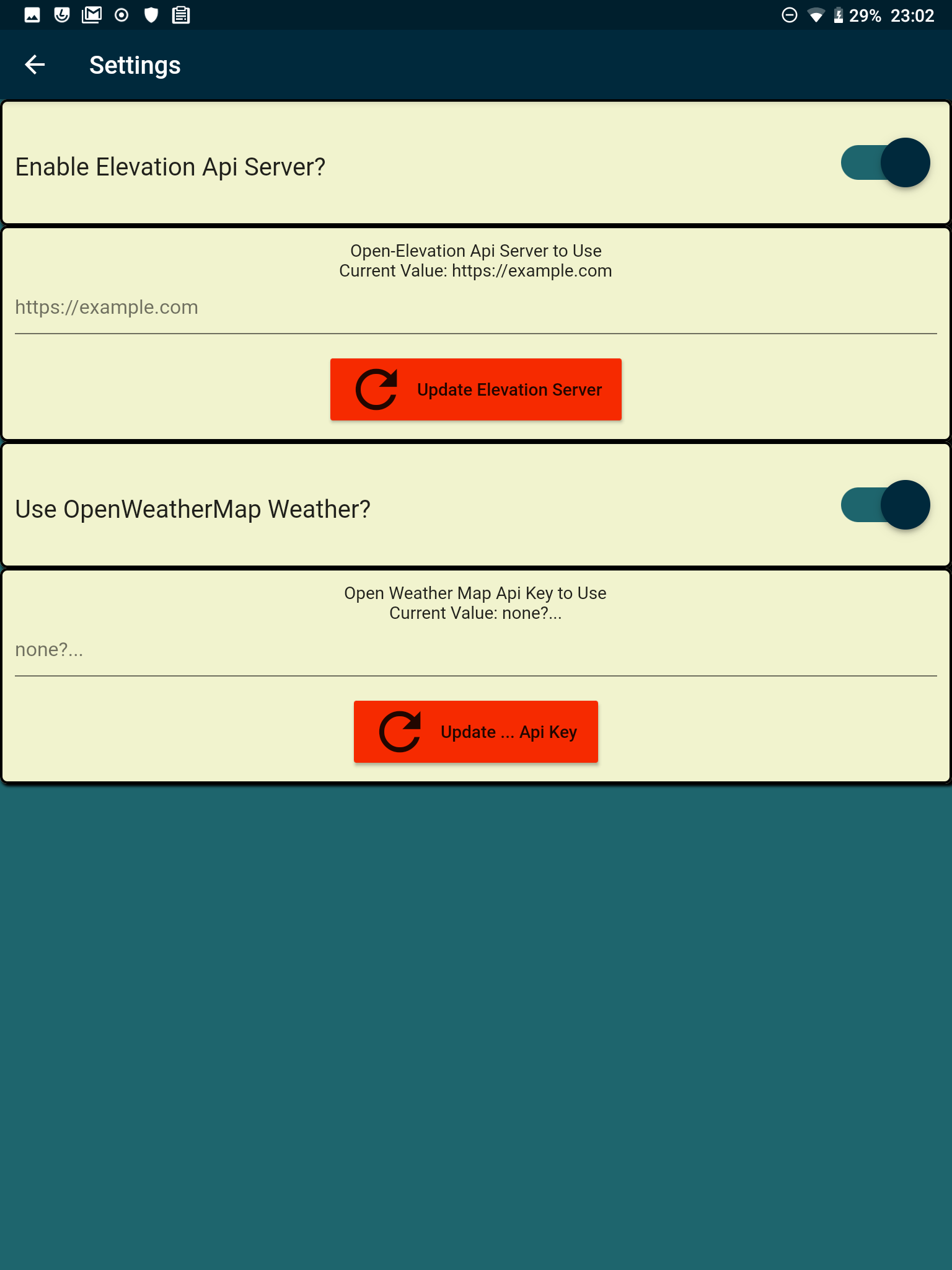
Using the gps coordinates you can get weather and/or elevation for each location you have saved. For weather you need a weather api key. For elevation you need to set up an elvation api server. The elevation api server requires some disk space; a $5 Lightsail server with 40G disk works.
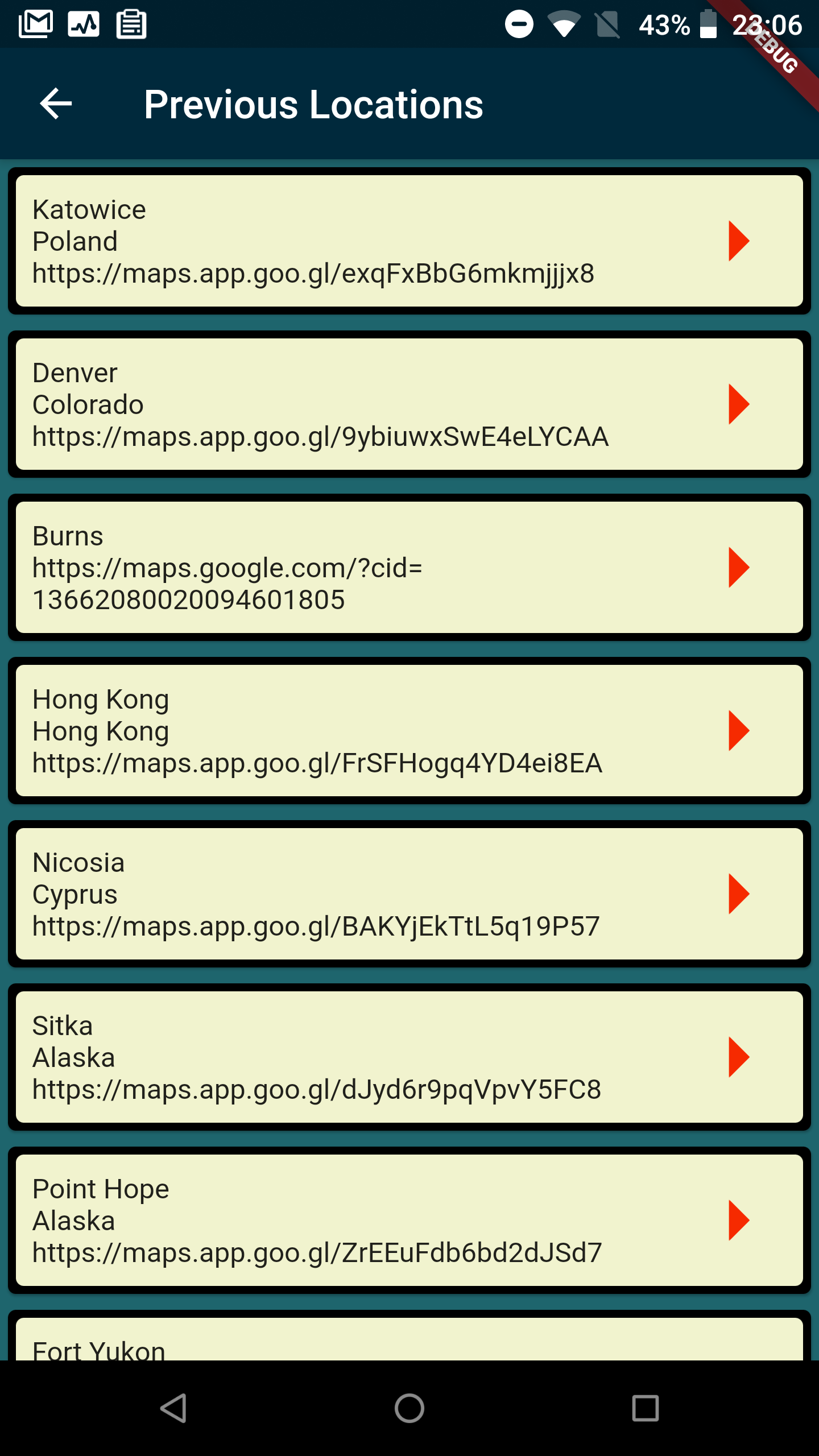
For each location that you save in your history you can also write some notes, including support for markdown, and including import/export from markdown or plain text file.
Data is cached locally in sqlite using sqflite, in order to economize network request tasks.
main screen
settings
weather and elevation can be enabled or disabled
history
road map
- add more things to be implemented
- add input from Bing Maps, OSM?
- add other elevation api server options
- include shared-prefs import/export in history import/export