mirror of
https://github.com/TrentSPalmer/libre_gps_parser.git
synced 2025-07-05 11:03:14 -07:00
42 lines
1.9 KiB
Markdown
42 lines
1.9 KiB
Markdown
# Libre Gps Parser
|
|
The essence of Libre Gps Parser is parsing gps coordinates from a map location that you share from
|
|
a map application. The location is requested using the [dart http](https://pub.dev/packages/http)
|
|
package, and then the raw text result is filtered with regex to pick out the gps coordinates.
|
|
|
|
You can take a look at the request and regex in
|
|
[`global_helper_functions.dart`](https://github.com/TrentSPalmer/libre_gps_parser/blob/master/lib/global_helper_functions.dart)
|
|
`parseMapUrl` function.
|
|
|
|
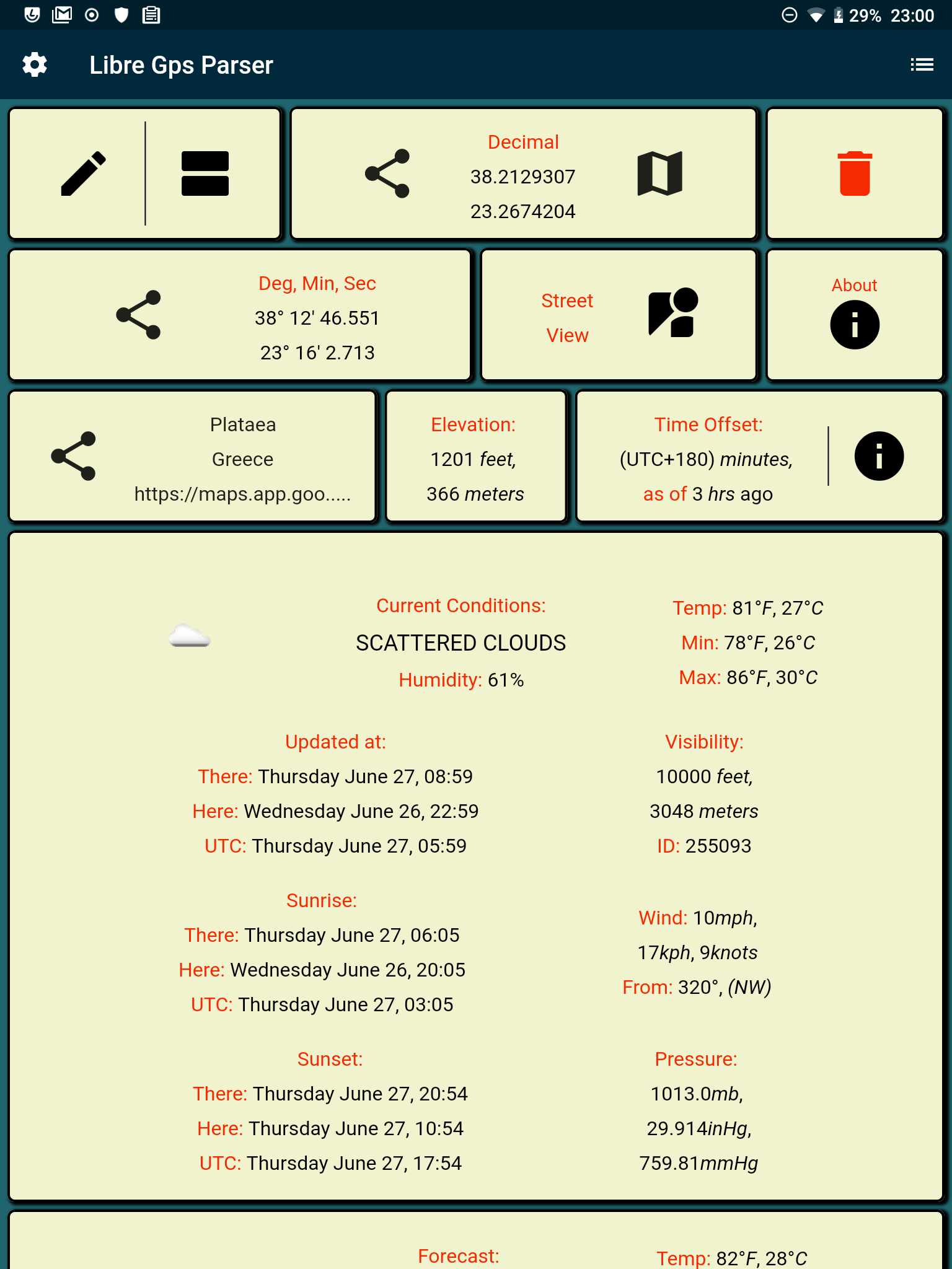
Using the gps coordinates you can get weather and/or elevation for each location you have saved.
|
|
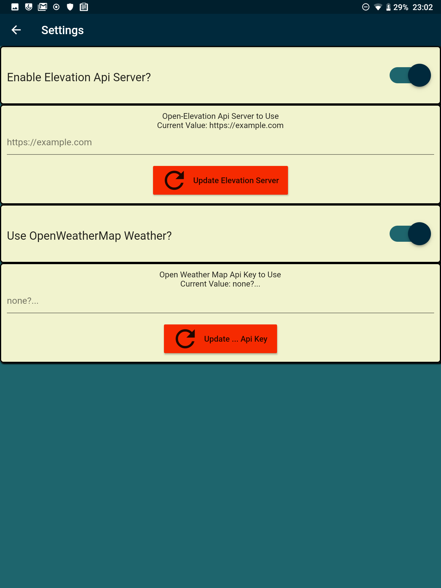
For weather you need a weather api key. For elevation you need to set up an
|
|
[elvation api server](https://github.com/Jorl17/open-elevation). The elevation api server
|
|
requires some disk space; a $5 Lightsail server with 40G disk works.
|
|
|
|
For each location that you save in your history you can also write some notes,
|
|
including support for [markdown](https://pub.dev/packages/flutter_markdown),
|
|
and including import/export from [markdown](https://pub.dev/packages/flutter_markdown) or
|
|
plain text file.
|
|
|
|
Data is cached locally in sqlite using [sqflite](https://pub.dev/packages/sqflite),
|
|
in order to economize network request tasks.
|
|
|
|
_____
|
|
### main screen
|
|
|
|
_____
|
|
### settings
|
|
weather and elevation can be enabled or disabled
|
|
_____
|
|
|
|
_____
|
|
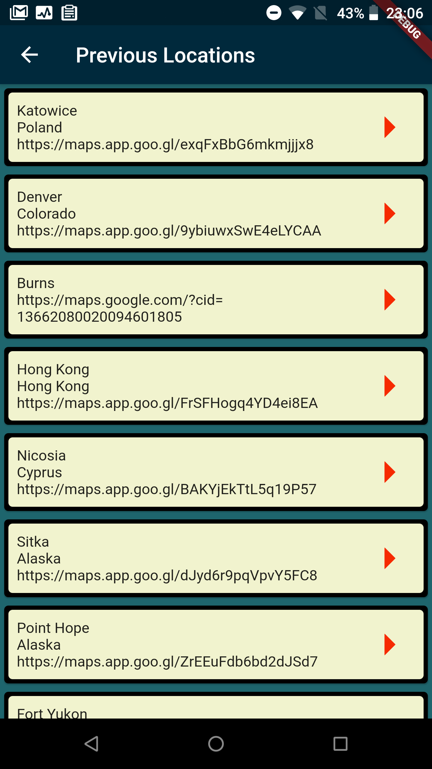
### history
|
|
_____
|
|
|
|
_____
|
|
|
|
## road map
|
|
*
|
|
* add more things to be implemented
|
|
* add input from Bing Maps, Mapquest apps
|
|
* add other elevation api server options
|